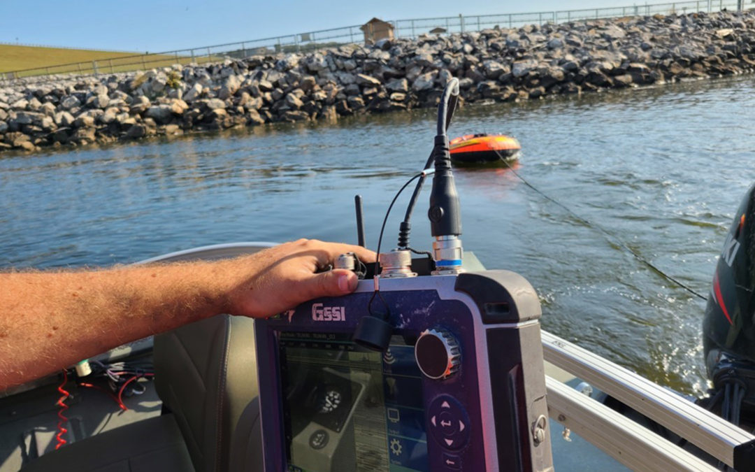
Bathymetry is a non-invasive and non-destructive method of mapping water depth and sediment stratigraphy. This mapping method is commonly used on lakes, rivers, spillways, and other freshwater bodies. At Echo GPR, we use bathymetry tools to improve flood risk forecasting, keep up with river maintenance, and monitor sedimentation progress.
These tools are essential to keeping the rivers and other freshwater bodies in the area safe and well-maintained. For more information about our bathymetry services, contact us at (913) 879-2200.
How is Bathymetry Data Used?
Many wonder, “what is bathymetry, and how is the data it collects used?” Bathymetry measures the depth of water, oceans, seas, or lakes. Echo GPR uses Ground Penetrating Radar (GPR) technology to detect the depths of water and map out various underwater features and structures.
Improves Flood Risk Forecasting
Bathymetry can improve flood risk forecasting by providing detailed information about the topography of a body of water. This information can create accurate digital elevation models, simulating water flow and predicting how floods are likely to behave in each area.
Additionally, bathymetry data can identify areas particularly susceptible to flooding. This includes low-lying areas or areas with many obstacles, like rocks or debris, that can impede water flow. At Echo GPR, we can collect data and show the worst areas of concern that may need mitigation or additional investigation.
Essential for Lake or River Maintenance
Bathymetry is essential for lake or river maintenance because it provides detailed information about areas at risk of erosion, sediment buildup, and other issues that can impact the health of the lake or river ecosystem.
For example, bathymetry data can identify areas of the river that are exceptionally shallow or have a steep slope, leading to increased erosion or sediment deposition. We use this information to provide recommendations to clients that will help them develop strategies for managing these areas. Additional ecological analysis may be required, but Echo GPR can assist with monitoring waterways for sediment change (see below), or data collection prior to and after dredging operations to measure progress.
Another way bathymetry tools are essential for lake or river maintenance is that they can monitor the changes in river morphology over time. This helps identify issues that officials taking care of the river or lake should address.
Monitors Sedimentation Progress
Bathymetry with GPR can monitor sedimentation progress by comparing bathymetric surveys conducted at different times and measuring the changes in the depth of the river, lakebed, or spill way. We use this information to identify sediment accumulation or erosion areas, which can indicate changes in the sediment transport dynamics of the river or ocean.
Methods we can use to monitor sedimentation progress include:
- Differencing: This method involves taking two or more bathymetric surveys at regular time intervals and subtracting one survey from the other to create a “difference” map. This map shows the changes in depth between the two surveys and can identify areas where sediment has accumulated or has lessened.
- Volume change analysis: Our team uses bathymetry data to calculate the volume of sediment added or removed from the river or ocean floor over certain time intervals.
The bathymetry data Echo GPR can collect provides valuable insights into the sedimentology of any fresh body of water. Our team can help to monitor sedimentation patterns in freshwater bodies around the Kansas City or Wichita area.
Benefits of Using GPR Technology to Gain Bathymetry Data
GPR is a powerful tool when gathering bathymetry data. Some benefits include the following:
- It has to ability to survey hard-to-access areas
- It can integrate with GPS for accurate geo-referenced points
- It works on frozen and non-frozen water bodies
- Can map ice and snow thickness
The only limitation is that saltwater bodies are too conductive for data collection. Luckily that isn’t a problem Echo GPR runs into too often in the Midwest!
Contact Echo GPR for More Information on Our Bathymetry Services
Echo GPR uses a ground penetrating radar that floats across the surface to collect data about bodies of water. Contact us today by calling (913) 879-2200 or filling out our contact form. We can provide more information about our bathymetry services and give you a free quote.

